Of Montana’s many unofficial nicknames – which include The Treasure State, Big Sky Country, and The Land of Shining Mountains – perhaps the most fitting would be The Last Best Place. Such a moniker implies a forgotten land rich in history and bursting with unexplored beauty. Many of the iconic sights that can be found here highlight the history and allure of the region, and deserve to be recognized and remembered.
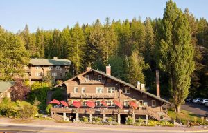
Great Northern Railway Buildings
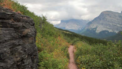
Located in and around Glacier National Park, these five building complexes date back to the park’s inception in the early 20th century. Built by Great Northern Railway to help lure tourists to the area, the buildings were modeled after Swiss chalets, providing both rustic backcountry experiences and more elegant accommodations. Belton Chalet was the first of the buildings to be constructed and perhaps the least successful due in large part to its remote location near the western entrance of the park.
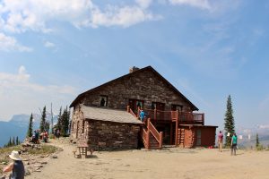
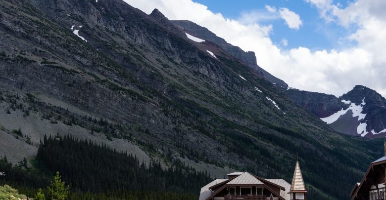
Conversely, Granite Park Chalet is centrally located within the park and is accessible by several of the area’s trails, making it a popular destination for hikers and horseback riders. Likewise, Sperry Chalet – which lies in a valley created by glacial erosion – is only reachable by trail, while Many Glacier Hotel rests on the shores of Swiftcurrent Lake – with most rooms featuring views of the lake or surrounding mountains. Two Medicine General Store, the final of the five complexes, is constructed entirely of log and continues to operate as a general store to this day, offering assorted snacks and souvenirs. Each of the buildings has been designated as historical landmarks by the Nation Register of Historic Places, and are notable for being the United States’ largest concentration of Swiss architecture.
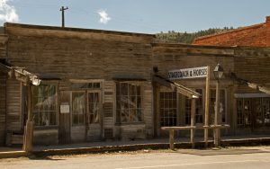
Virginia City Historic District
Virginia City, Montana was founded in the 1860s after a major gold rush on the area and served as the territory’s capital for ten years. At one time, the population of the area was estimated to be somewhere in the neighborhood of 10,000 residents. Today, what remains of this once prosperous mining town includes over two hundred late 19th century buildings, many of which were bought and restored by Charles and Sue Bovey in the 1940s.
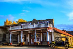
Thanks to the efforts of the Boveys, Virginia City is one of the most well-preserved gold rush towns of the era, resulting in its designation as a National Historic Landmark. Some of the preserved properties include log cabins, Victorian homes, and commercial structures. The most recognizable of the remaining buildings, however, would have to be the Madison County Courthouse. This old west town is a popular tourist destination and operates as an open-air museum, allowing visitors of the area to experience a taste of frontier life through walking tours of the area.
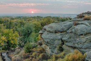
Pompey’s Pillar National Monument
This rock formation in southern Montana was included in the Louisiana Purchase and became an area of exploration on the famed Lewis and Clark Expedition. Named after the son of Sacagawea, Lewis and Clark’s guide, this National Monument has come to stand as a symbol of the development of the early west.
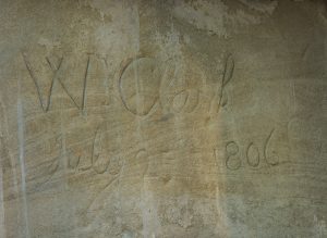
As they happened upon this 200-foot rock structure on the return leg of their journey, Captain William Clark stopped to carve his signature and the date into the imposing outcropping, where it remains today for visitors to view from the boardwalk. If you look closely enough, you can also spy animal drawings carved into the sandstone by early travelers of the territory.
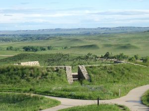
Little Bighorn Battlefield National Monument
The site of the Battle of Little Bighorn today is marked by several memorials commemorating the many lives lost in that historic campaign. The most imposing of these tributes is the Memorial Marker, a large granite landmark located atop Last Stand Hill which designates the mass grave of many of the soldiers whose lives were lost in the battle. Smaller gravestones are scattered across the outlying land to denote the location of additional fallen combatants of the 7th Cavalry.
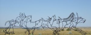
Over the years, monuments have been added to honor Native American warriors who either participated in or sacrificed their lives during the attack, including Crazy Horse, who led the Lakota tribe to victory over the U.S. troops. Red granite markers indicate the final resting places of Cheyenne warriors such as Noisy Walking and Lame White Man, the only chief to perish in the battle. Lieutenant Colonel George Custer, who was originally among those buried on the battleground, was later reinterred at West Point Cemetery.
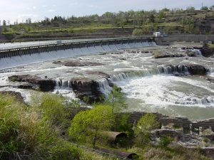
Great Falls
The Great Falls of the Missouri River consist of five separate waterfalls located along a 10-mile stretch in northern Montana. All told, the river drops a total of over 600 feet in elevation from the first waterfall to the last. Black Eagle Falls, the first in the series, featured a drop of just over 26 feet before a dam was constructed to help generate electricity.
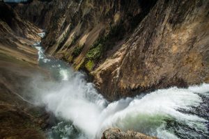
Rainbow Falls, a 44-foot drop which flows over a ledge of sandstone, also features a hydroelectric dam, the creation of which has formed a reservoir that largely obscures the less impressive 6-foot drop of Colter Falls upstream. Crooked Falls, also known as Horseshoe Falls due to its horseshoe-shaped cliff, is the only one of the cataracts to remain largely untouched, while Big Falls – the last in the series – stands as the most imposing with its 87-foot drop and 900-foot breadth, though much of the water is diverted upstream to yet another hydroelectric dam.
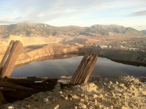
Berkeley Pit
At a depth of over 1700 feet and spanning a mile in length and a half-mile in width, this one-time open pit copper mine is now filled to a depth of nearly 900 feet with heavily-acidic water. Designated as a Superfund site, a government-sponsored cleanup program, the pit water carries high levels of heavy metals which could pollute surrounding groundwater in the near future. However, the potential environmental emergency hasn’t stopped tourists from visiting the pit, whose development once displaced many Butte residents. Plans have been put into place to help slow the rise of the water level, including the erection of a water treatment plant. In the meantime, visitors can observe this notorious environmental oddity from a viewing platform or patronize the adjacent gift shop.