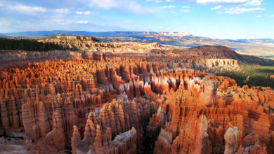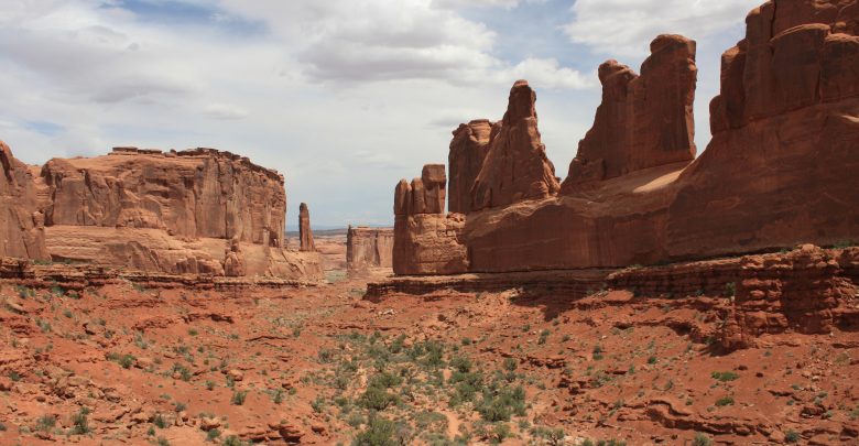
The beautiful state of Utah became the 45th to join the union on January 4, 1896, and it was a welcome addition. More than 3.1 million people call the Beehive State home, and millions more visit each year. Utah’s mountains, landscapes and wide variety of natural wonders draw visitors from all over to enjoy sightseeing, hiking, nature exploration and—one of the most popular activities in the Salt Lake State—skiing. Here are just five of Utah’s natural wonders that will have you making plans to head to Utah on your next getaway.

Arches National Park
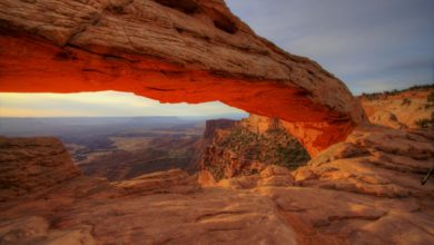
Arches National Park is located 4 miles north of Moab, Utah. It protects a 120-square-mile area of more than 2,000 natural sandstone arches. The arches were carved and formed by years and years of erosion and weathering. The most famous arch in the park—Delicate Arch—is a 60-foot-tall freestanding arch. It’s so well-known, that its likeness is portrayed on Utah license plates. The longest arch in the park and in the western hemisphere is Landscape Arch with a span of over 290 feet. It’s the fifth-longest natural arch on earth. Double Arch is a very close-set pair of natural arches in the park. One side of the arches has the tallest opening at 112 feet above ground, and with a span of 144 feet, Double Arch is also the second-longest in the park. Since 1977, 43 of the massive arches have collapsed.

Arches National Park is best known for its arches, but there’s a lot more to the park. The park is also home to Balanced Rock, which has a total height of 128 feet. The rock itself rises 55 feet above the base and is the size of three school buses!
Visitors to the park enjoy breathtaking views of the arches’ natural beauty. The park also has various hiking trails. Some are wheelchair accessible, and some include rock climbing and canyoneering. Visitors also enjoy stargazing at night because of the very dark skies over the park that allow them to see thousands upon thousands of stars. For more information or to plan your trip to see the arches, please visit www.nps.gov/arch.

The Wasatch Mountain Range
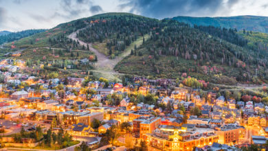
The beautiful Wasatch Mountains stretch over 160 miles from the Utah/Idaho border south through central Utah. The range is located on the eastern edge of the Great Basin Region and on the western edge of the Rocky Mountains. The Wasatch Mountains are the result of a long history of volcanic activity and glaciation in the area. Within the range stand huge mountains that have an average height of 9,000 to 10,000 feet in elevation. Mt. Nebo has the highest elevation in the range at 11,877 feet above sea level. More than 85% of Utah’s residents live within 15 miles of the mountains—mainly in the valleys to the west.

Throughout the range, there are thousands of miles of hiking and mountain biking trails. There are also several scenic drives and rivers. Historical routes, byways, and backways allow visitors to explore the area’s diverse wildlife and scenery. And because the Wasatch Mountains get so much snow—up to 500 inches a year in some places—skiing is very popular in the area. Skiers have 12 different ski resorts from which to choose. Other recreational activities in the mountains include horseback riding, camping, golfing, snowmobiling, kayaking, whitewater rafting, and even balloon flights.

Bear Lake
Bear Lake is a natural freshwater lake on the Utah/Idaho border. It is called “the Caribbean of the Rockies” because of its vibrant turquoise-colored water, which is a result of calcium, limestone and other minerals suspended in the water. The lake is 109 square feet in size, 18 miles long and over 7 miles wide, with a depth of 208 feet.

Bear Lake State Park surrounds the lake and offers many choices in recreational and water activities including fishing, scuba diving, boating, camping and more. The park, which was opened in 1962, is available to the public year-round. There are three main areas of amenities in the park—the State Marina, Rendezvous Beach and the Eastside Areas, which include First Point, South Eden, Cisco Beach, Rainbow Cove and North Eden. Each area has something for every member of the family to enjoy. Day use permits can be purchased as 1-, 2- or 3-day passes, and camping fees vary based on the area and hook-ups. Visit www.stateparks.utah.gov for more information.

Coral Pink Sand Dunes
Southwestern Utah’s Coral Pink Sand Dunes were formed from the erosion of the pink-colored Navajo Sandstone in the area. High winds pick up the sand and are funneled through an opening between the Moquith and Moccasin Mountains. The velocity of the wind as it’s being forced through that opening, followed by the sudden drop in velocity after the winds pass through it cause the winds to deposit the sand on the dunes. Because they are shaped and formed by the winds, the dunes can move as much as 50 feet in just one year.

Coral Pink Sand Dunes State Park was established in 1963 and protects the dunes, and inside the park, visitors can enjoy a wide range of activities on and around the dunes. There are hiking trails, a sand dunes overlook area, campsites and more. About 90% of the dunes are open to off-highway vehicles like ATVs, and 100% of the dunes are accessible for hiking and playing.
Entry fees are $8 per vehicle per day and $4 for Utah residents ages 62 and better. Single campsites cost $20 per night, and double sites are $40 per night. Group campsites can be reserved as well and cost $120 per night for up to 5 units. Visit www.stateparks.utah.gov for more information.

The Great Salt Lake
The Great Salt Lake is located in northern Utah and is the largest salt lake in the entire western hemisphere. It is also the largest lake in the United States outside of the Great Lakes and the 33rd largest lake on earth. It is so massive in size that astronauts use it as a reference point from outer space. At its normal level, the lake has a surface area of 1,700 miles, but over time, it has ranged from a surface area of 950 square miles to 3,300 square miles, depending on precipitation. The construction of tourist attractions and amenities is not possible because of the surface area’s wild variations.

Because the Great Salt Lake is so shallow—with an average depth of 16 feet—the water level is affected by very dry and very rainy seasons. In a year of low precipitation, the lake’s water level falls and in rainy seasons, it can rise dramatically. The lake is home to 11 recognized islands, the largest of which is Antelope Island at 42 square miles.
Because of the Great Salt Lake’s salinity, very few species can live in it. Only brine shrimp and a few species of algae make their home in the lake. Because of a salinity level of the water that ranges from 5% to as much as 27%, the lake has earned the nickname of “the Dead Sea of America.”

